Welcome to New England Drone Solutions
An Advanced Drone Service Provider
Serving Connecticut and the greater New England region, New England Drone Solutions takes drones far outside the normal bounds of traditional photography and videography.
Offering certified thermographic imaging and analysis, thermal search for lost pets and animals, aerial mapping and land use data, and 3D modeling/digital twinning of existing sites and structures, NEDS combines the latest in aerial imaging with the powerful software necessary to produce actionable data for your specific use case.
Services
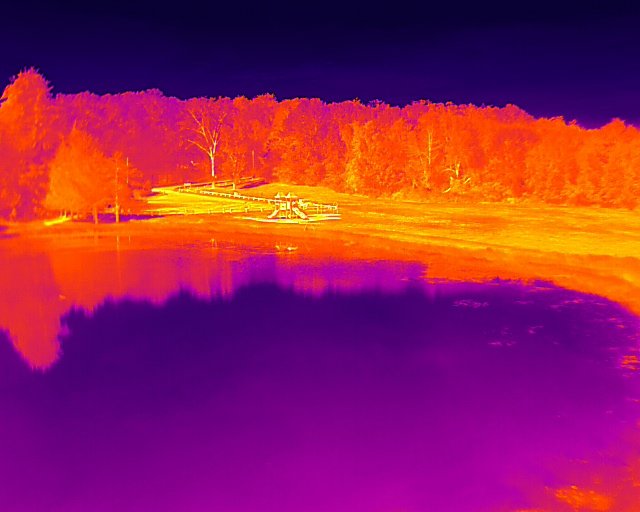

Thermal Imaging and Analysis
Thermography is the detection and interpretation of infrared radiation. As a certified Level 1 UAS thermographer, I am qualified to gather and analyze thermographic data for your site and help identify problems and anomalies. My thermal drones offer some of the highest resolution available and my knowledge of industry standard best practices helps to ensure that your data is collected correctly, accurately, and efficiently.
APPLICATIONS:
Building envelope inspection
Rooftop inspection
Chimney inspection
Solar installations
Thermal Animal Search
New England Drone Solutions uses drones equipped with thermal imaging sensors to help pet owners and those with livestock locate their animals when they go astray. While those with visual-only drones may be well-intentioned, standard visual sensors are largely ineffective in the location and recovery of lost animals.
Thermal search allows for the identification of the animal’s heat signature, and then a visual inspection to determine whether the signature is related to the target animal. Thanks to the highly sensitive nature of today’s thermal sensors, the animal can also be detected at greater distances, allowing us to cover more ground in less time making for a more efficient search.
APPLICATIONS:
Lost dogs
Lost cats
Lost horses
Lost goats, sheep, and other livestock
Identification of wildlife on properties


Rooftop/Chimney Inspection
New England Drone Solutions can provide safe, effective rooftop and chimney inspections without the need to climb onto structures. Inspections can be visual or combined with thermal imaging to gain additional insights depending on use case. Rooftop anomalies can be identified non-destructively and enable targeted inspection of problem areas. High-resolution camera zoom means that even the smallest features can be identified and photographed for further inspection on the ground.
APPLICATIONS:
Rooftop inspection
Home inspection
Commercial real estate inspection
Chimney inspection and service
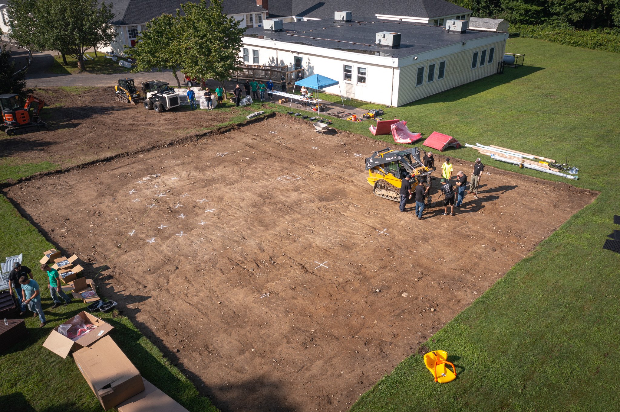
Construction Progress Monitoring
Gain real-time insights into the ongoing progress of various construction projects without ever setting foot on the site. Construction progress monitoring allows for weekly, bi-weekly, or monthly overflights of a construction site to capture and compare data over time. Overlays allow for a slider-like effect to enable direct comparisons of specific areas. And, because the images are captured using the same high-accuracy satellite navigation systems used in photogrammetric applications, clients are assured that their images are shot from the same location in space every single time - including altitude - to within 1-5 centimeters.
APPLICATIONS:
Construction site progress monitoring
Land clearing
Land reforestation
Landscape changes

Photogrammetry/Orthomosaic Production
Photogrammetry is the process of gathering many high-resolution images (generally in the hundreds or thousands) and using powerful software to interpret and infer data from those images when they are stitched together. Software models and artificial intelligence allow for estimated measurements (not to be confused with a survey which can only be provided by a licensed surveyor) of space, distance, and volume.
While most drone GPS systems are no more accurate than the GPS in your phone, New England Drone Solutions uses highly precise satellite navigation and ground control systems that allow for accuracies to within 1-5 centimeters on all three axes (X, Y, and Z) making the data highly usable for a number of applications.
APPLICATIONS:
Mapping
Land usage data
Digital elevation and surface models
Land acquisition intelligence

3D Modeling/Digital Twinning
Gain incredible insights into existing sites and structures with the creation of a 3D model captured at nearly photorealistic resolutions. Preserve existing structures prior to demolition or renovation and navigate the model in full 3D on a computer or mobile device. Combine 3D modeling with construction progress monitoring and “fly” through a site, looking left, right, up, and down as if you’re there. It’s a technology that truly needs to be seen to be believed. Contact New England Drone Solutions for a demonstration of what 3D modeling and digital twinning can bring to your ongoing project.
New England Drone Solutions serves the following areas:
All of Connecticut
All of Massachusetts
All of Rhode Island
All of New Hampshire
All of Vermont
Southern Maine
Eastern New York
Still not convinced? Schedule a free demonstration flight.
Many of the benefits that come from advanced aerial imaging are easier to see, rather than read about. It all looks great, but it can be difficult to visualize how it can be used in your business. That’s why I’m happy to schedule free demo flights. I’ll come out to your site, fly it, capture data, and then give you an interactive walkthrough of a sample of the data that was generated. Seeing really and truly is believing.
By the end of that call, you’ll wonder how you ever did business without having drone-generated data at your disposal.